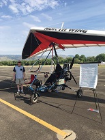
Moore Airtime
Trike Flights and Instruction in the Denver, Colorado Area
Weather and Flight Planning Resources for the Denver Area
![]()
Before You Go:
FAA WeatherCams - Weather cameras, METARs, TAFs, TFRs, and other flight planning resources
Forecast Discussion - The authors of TAFs explain their reasoning
| DIA | NWS Weekly | Hourly Graph | METAR | TAF | AirNav | ||
| Rocky Mountain Metro | NWS Weekly | Hourly Graph | METAR | TAF | AirNav | Colorado Air and Space Port | NWS Weekly | Hourly Graph | METAR | AirNav |
| Boulder | NWS Weekly | Hourly Graph | METAR | AirNav | Berthoud AWOS | Dakota Hill AWOS | |
| Longmont | NWS Weekly | Hourly Graph | METAR | AirNav | |||
| Erie | NWS Weekly | Hourly Graph | METAR | AirNav | |||
| Platte Valley | NWS Weekly | Hourly Graph | AirNav | ||||
| Ft. Collins Loveland | NWS Weekly | Hourly Graph | METAR | AirNav | |||
| Greeley | NWS Weekly | Hourly Graph | METAR | AirNav | |||
| Meadowlake | NWS Weekly | Hourly Graph | METAR | TAF | AirNav |
Windy.com - Current and forecast animations for surface wind, winds aloft, temperatures, and more
Satellite - NOAA Satellites and Information
Soaring Forecast - Precise details about the local atmosphere
Air Sports Net - Graphical representation of data provided by the National Weather Service.